Sunday, October 29, 2006

Exploring in Louth!

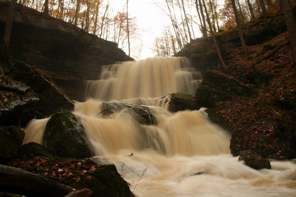
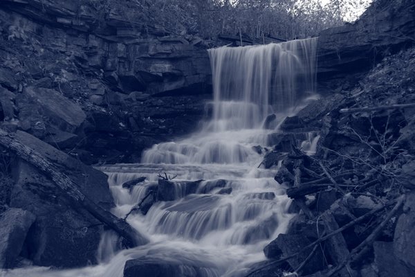
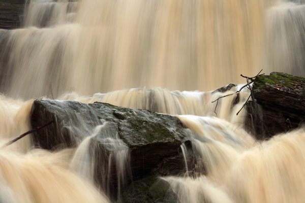
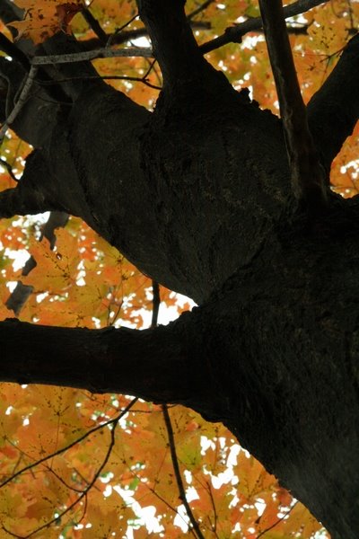
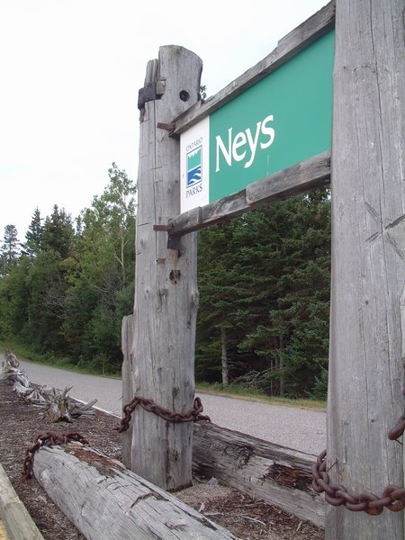
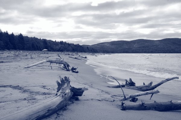
Today I headed over to Louth to explore two waterfalls, 17th Street Falls and Louth Falls.

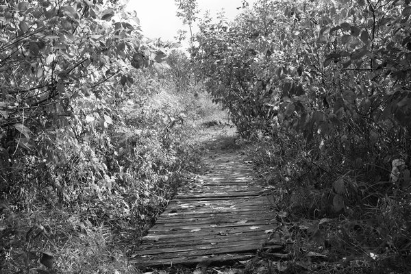
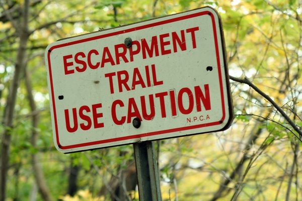
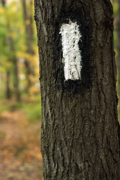
Both are located in Louth, a county situated just north-west of the city of St.Catharines. To access both of these waterfalls, from St.Catharines, travel along St.Paul Street West until it becomes King Road. Follow this until you reach 17th Street..watch as it comes up quick!Turn left, and follow around an S curve in the road, and just below the next hill, the shoulder widens on both sides of the road, you can park here. You will notice the Bruce Trail white blazes on the trees and hydro poles as the trail follows 17th Street up the hill. If you trailblaze down the slippery steep escarpment to your right, and follow the creek upstream for about 100-metres, you will reach 17th Street Falls. The hike to this falls can be treacherous, so please be mindful of your footing in this ravine. It's not too deep or steep, however the water is chilly, and the loose rocks and wet leaves dont make a very safe combination at times. Wear sturdy shoes or boots for this hike.

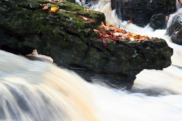
17th Street Falls is also called "Middle 18 Mile Creek Falls".
You can view my gallery dedicated to this fall by Clicking here.
You can also view more information on this falls at the Waterfalls of Ontario website.
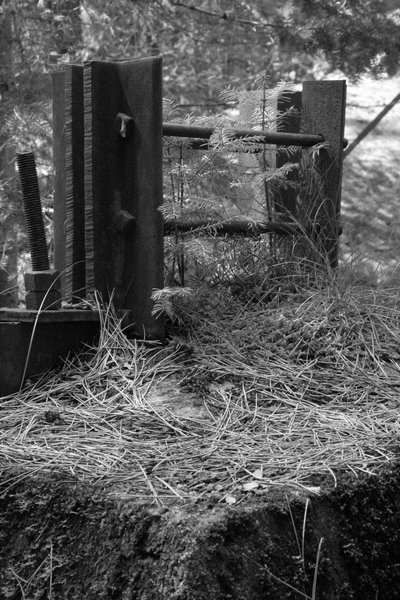
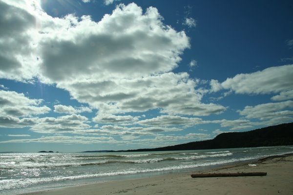
'Here are the photos from today's visit:
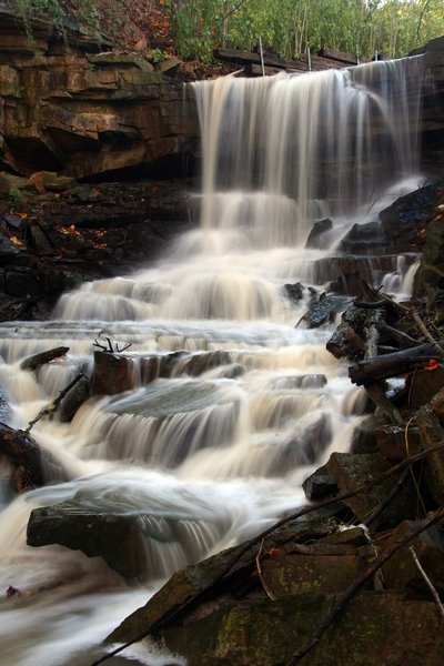
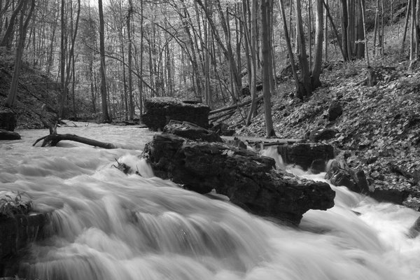
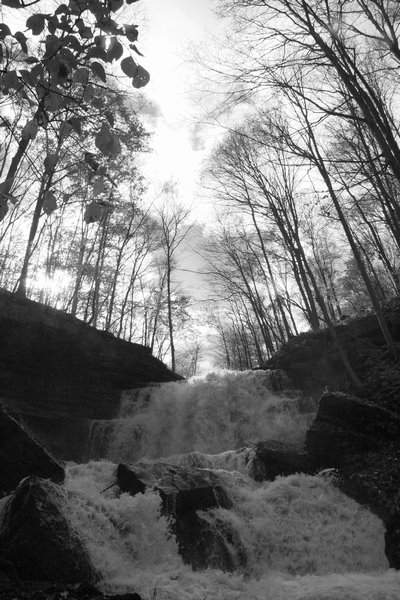
After a refreshing hour climbing through the ravine and marvelling over the beauty of 17th Street Falls, I made my way back to my car and drove on to Louth Falls.
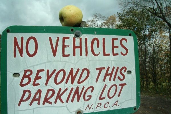
Louth Falls Conservation Area can be accessed by, continuing along 17th Steet, up the hill..watch for Staff Avenue, which will be your first left. After turning left onto Staff Avenue, continue around the bend. You will see a small parking lot on your left, with stones marking the entrance-way.
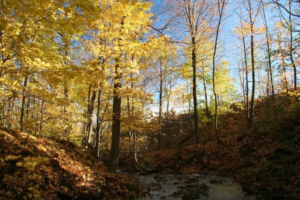
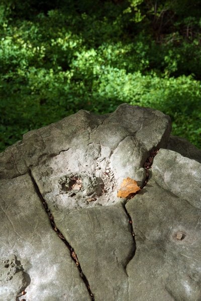
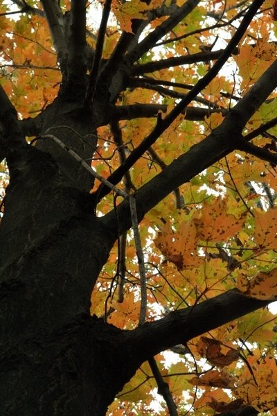
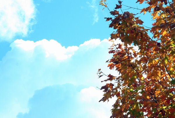
Follow the Bruce Trail, but follow it to the right as you approach the escarpment. It will lead you down a hill, and to Louth Falls. The trail is lovely in the conservation area, and leads one past rich green moss covered limestone boulders. One can see the lovely colours of reds, browns, and deep rich yellow leaves blanket the forest floor, as most of the trees have shed their leaves.
To view my Gallery dedicated to Louth Falls, Click here.
For more information on the Falls, you can go to the Waterfalls of Ontario site. Alternate directions are also available.
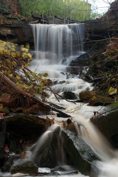
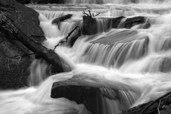
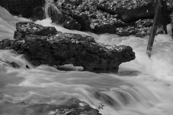
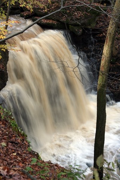
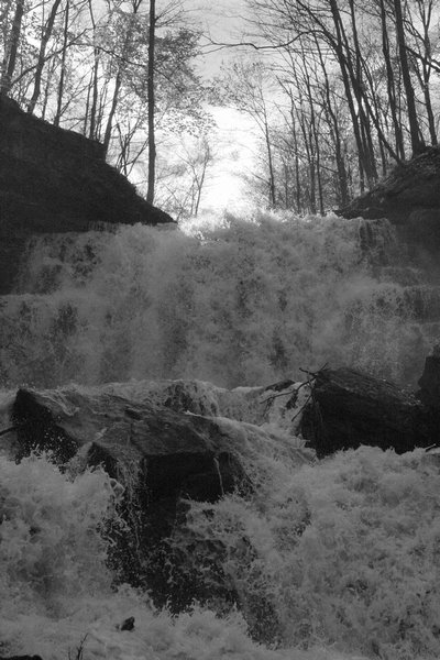
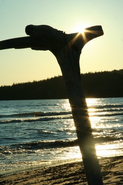
Here are photos from the top of the Falls as well as the upper river:
I was exploring a bit along the crest of the falls as I had in drier months. This was my second visit to the falls when the falls was actually flowing. I have been here many a time when it was not. It was still early in the day, and the sun hadn't yet reached mid-point in the sky as of yet. The morning light through the trees cast neat shadows on the forest floor surrounding the river.
I got some good views of the falls, when I decided to start heading back to the car.
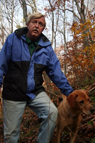
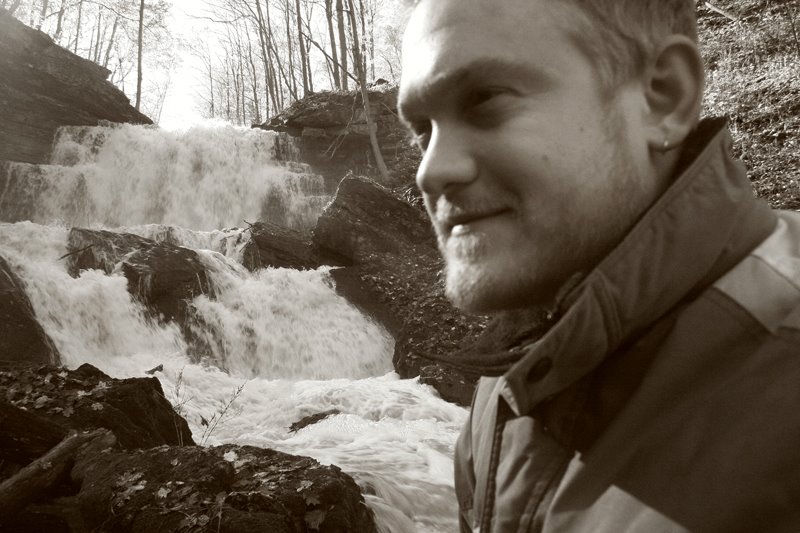
A man and his dog were walking along the trail towards me. I stopped to chit-chat with the gentleman and had asked if there was an access point to get to the bottom of the falls. He confirmed that there was and decided to show me how to access it.
The man was very accomodating and was a welcome guest for my afternoon hike. I had a hiking partner!
He was an older gentleman in his 50s, and I found after chatting with him that he had a great story to tell!
His name is Tarmo Heyduck. He was born in Sweden, and had come to Canada in 1951. He was a teacher of English and History for quite a number of years at Governor Simcoe Secondary School, and has published a book, entirely in Estonian, and is a compilation of his writings and research on the biographies of the elite and prestige of frat at the University in Estonia. His book also covers the history of the Estonian society, and reaches far back into time to the Baltic Revolution. The intriguing thing about the book is that it is written entirely in Estonian.
Bravo to Tarmo!
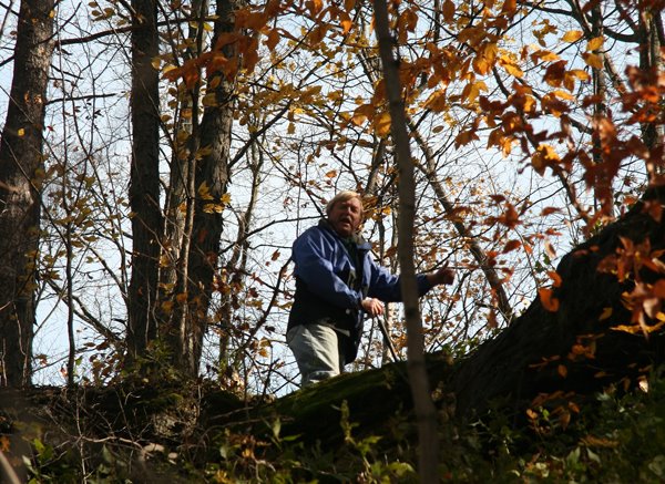
Tarmo and his dog T.KO were wonderful company for my afternoon at Louth Falls Conservation Area. Tarmo's successes were and still are an inspiration for my own self. Tarmo didn't continue on to the falls with me, and had decided to scale the high escarpment embankments. This gorge was also trail-free, and we had to trail-blaze our way through it. I had watched Tarmo as he exited the ravine, just to ensure that he safely arrived to to top. He did and we waved our goodbyes. I shall look forward to corresponding with Tarmo Heyduck.
I continued on along the rugged embankment to the Niagara Escarpment. Fallen trees were a definite obstacle..along with the wet rocks and slippery clay..it really was a treacherous hike to the bottom of Louth Falls..but so very worth it. Here are the photos from Louth Falls:
After an hour propped up against a wet moss-covered rock, with my foot in the water swirling around me and mist from the falls soaking my jacket, I decided to head back. In order to gain access to the top of the canyon, I would have had to walk all the way back to where Tarmo and I came in, or attempt to scale the 70 degree angle embankment above me. I did as such, without too much trouble. My monopod served its purpose well with the photos, as well as a walking stick. Nothing better than a sturdy and strong walking stick when climbing the Niagara Escarpment.
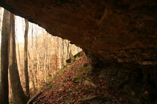
I ended up following underneath the cliff ledge as it outcropped over the embankment below me. Glacial flows from the ice-age days left behind the hollowed out ledges which made for a perfect forground for a photo, as well as a path to exit the ravine.
Louth Conservation Area..one very fun place and certainly a gem of the area. Again, be careful of your footing when hiking in this ravine, as there isn't a defined trail, which means you have to make your own trail. Bring a good strong set of shoes or boots, know your footing, and bring along a walking stick to assist you.
And so after an exhausting and exhiliarating hike, I made my way succesfully to the top of the Louth Falls ravine and cheered my accomplishment of another completed waterfalls!
~Tom

Monday, October 23, 2006

FRONT PAGE!!

FRONT PAGE: NIAGARA FALLS REVIEW
***

Given a press pass, I made my way down to the Niagara Parkway at 8am on Sunday Oct 22nd.
My assignment: To capture the Start of the Half-Marathon, as well as the Male & Female Winner of the Full Marathon.
This Marathon was the 6th Annual event, sponsored by the Niagara Fallsview Casino.
The only international-based marathon to cross an international border began in Buffalo at 10am, with the half-marathon beginning at the same time near Fort Erie along the parkway.
The weather was absolutely dreadful with pouring rain all day. Luckily enough for good preparation, I was equipped with a monopod, umbrella, and duct tape to make myself a small shelter and camera prop.
Enough to make front page news!
I was to be published 5 times in today's publication of the Review, including the above two photographs.
These photos and more from this big event to come!
~Tom

Friday, October 20, 2006

Woodend Conservation Area - October 14

While in Niagara Falls this past Saturday Oct 14th, I really had an aching in my heart to get out to the woods, to get some fresh air for myself, and maybe grab some fall colours at the same time.
After my shoot at the Chippawa Arena for Penalty Free, I made my way over to Woodend Conservation Area.


Woodend is located along the Niagara Escarpment, just between the cities of Niagara Falls and St.Catharines. The Bruce Trail travels through this park, and branches off into many side trails that one can take to view different areas of this wooded area.

Woodend pays homage to an education centre, located in an old rustic home built atop the escarpment, as well as the ruins of an United Empire Loyalist homestead and limestone kiln (located below the ledges of the escarpment). The park, with it's rolling hills, and limestone rock formations is certainly a treat for those just wanting to get out for even an hour away from the bustle.


I took a short walk this day as the wind was bit cool and damp from the rain we had over the previous few days. I explored the grounds around the education centre and took some photos of the old homestead from atop the escarpment ledges. Unfortunately I had forgotten to pack my hiking boots this day, and declined to go exploring into the old ruins. I shall like to return to do as such.

The fall colours at Woodend this year were very yellow and a bland red...only but a selected few were an deep lush red, which contrasted nicely against the overcast fall skies..

It was an enjoyable walk and I was provided with some fun photo opportunities. Another park to add to the list of proposed return visits. Those wanting to visit the park, I will tell you it is worth the visit, however please watch how fast you drive in to the park, as the long winding road in is very bumpy with pot-holes. Please drive carefully and slow, and enjoy this peaceful park located in the heart of the Niagara section of the Escarpment.

~Tom

Tuesday, October 17, 2006

SUMMER '06: Day 5: Escape to the POW Camp!

Well with the rate I am going at with getting these photos out from my summer vacation from back in AUGUST..yes two months ago...it will take a year to complete the 15-day adventure I had in Northern Ontario.

Tons of photos, tons of adventures..too much to write about..not enough time really. I've also been plagued with complacency and a bit of a writer's cramp to tell the truth..however life is full of these little time-stops, or growing pains so to speak.

Embraced..done..for now ;) Moving on..

...Remember if you were reading last that we needed to escape the "inhospitable" weather along the shores of Lake Superior Provincial Park at 4am due to the high winds coming off of the lake for a whole two days?
Our next park on the agenda was Neys Provinical Park

... and boy did we arrive early. So early that we had to wait for the people to leave "our site" before we checked in. So we decided to go for a walk along the beach. Funny thing was about this long white sandy beach was that there seemed to be more driftwood than sand. Driftwood piles from visitors were propped up along the beach. Driftwood formations placed together by beach-goers were the sight to see on this northern Lake Superior beach. Driftwood that has been lying there for years, as well as fresh specimens rolling in from the lake. It was a remarkable sight.


Knowing that we had another couple of hours to kill, and after a driftwood hike along the beach, we decided to check in at the visitor's centre and take a tour of the "ruins". Neys Provincial Park is located at the site of the old "Camp W", a German prisoner-of-war camp from World War II era. (Below, a photo of drawing by an inmate at Camp W, on display in the Visitors Centre)

The ruins weren't much, however the tour guides were quite friendly and accomodating with their knowledge of where the old camp was. The POW camp was basically adjacent to the beach, and what was left of the old buildings were only but a few old rusty pipes and cement barriers partially buried in the sand between the sparse tamaracks next to the visitors centre.

Thanks to Dean for the tour!

After the hour-long tour, we were finally able to set up camp. Afterwards, we enjoyed a cool but refreshing swim in Lake Superior, people-watched along the beach, and retired back to the campsite for dinner. We then took in a lovely sunset amongst the driftwood.


I shall like to return to Neys and spend a few more days in the park. Due to timing, we weren't able to take in the park's nature trails or spend more time with the other sights in the park.

Our next day would take us to Thunder Bay, via a few other really cool stops on the way..big day for Day 6!

Up Next..The old Ghost Town, some waterfalls, and into Tbay!
aluminum info
Thank you for being Visitor: